 |
|
Archway - Tower Bank |
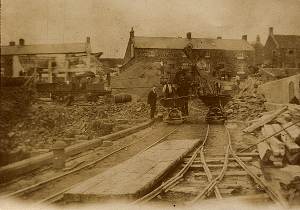
Craster Harbour ConstructionEvidence for the construction of the north pier is taken from a typewritten note that is related to, and contemporary with, a set of six photographs taken during its construction held in the County Collection at Woodhorn (ZCR Box 22). Unfortunately the photographs themselves are not available to the History Group for publication. 1. The pier is made up of several sections, with cross walls. The sections are filled with rubble, some taking up to 900 tons of filling. When each section is full it is covered in a layer of concrete, steel rods put in from side to side and another layer of concrete put on to form the roadway. 2. This photograph shows the tramway laid along the finished section to deliver materials to the work in trolleys moved by man power. A steam powered concrete mixer was located at the entrance to the pier. Even though the pier was under construction, the memorial tablet to Captain J C P Craster was already in place. 3. The sections were filled by lifting the trolley using a crane. The photograph shows the crane incorporated into a trio of shear legs at the end of the pier. 4. The parapet was made by building up a shuttering mould and filling with concrete, with layers of stone to bind the whole together. The concrete left to set for three or four days, the shuttering removed and the new parapet left to 'air' dry. 5. This photograph (absent from the box) is said to show the end of the north pier, where the rock was not high enough to found upon. It was so low that it was only possible to work her eat the lowest spring tides. 18inch of sand had to be taken off the top of the rocks to expose it and concrete laid to bring the rocks up to level of the rest of the rock. It was only possible to work there for three hours at the outside before the sea drowned the workers. 6. This photograph (again, absent from the box) shows a general view of the north pier, including an "old boat raised on a timber staging. This boat is connected by a long pipe with the burn and is kept full of water by a steam pump. Pipes convey the water to wherever it is wanted, either the stone crusher engine, the concete mixer engine, when it is working, or finally to water the filling.” It appears that redundant boats were put to other uses as well as being turned upside down to make into sheds. Much of this can be seen in the following photograph collected by Eva Archbold and made available to the History Group by Jack Browell. The tramway serving the construction can be clearly seen running down the pier, passing the memorial plaque to Captain Craster that was installed early in the construction. Behind the trolleys, at the head of the pier, is the crusher and piles of materials. To the left of this stands a steam driven 'sentinel' lorry and behind that is a robust scaffold bearing the coble used as a water reservoir.
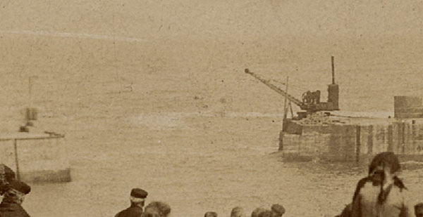
That the south pier posed more of a problem is evident in TW Craster's account of its construction, which refers to delays, uncertainty and postponement of its completion date. The following photograph shows the crane at the end of the incomplete pier.
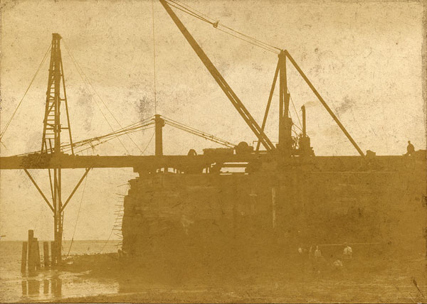
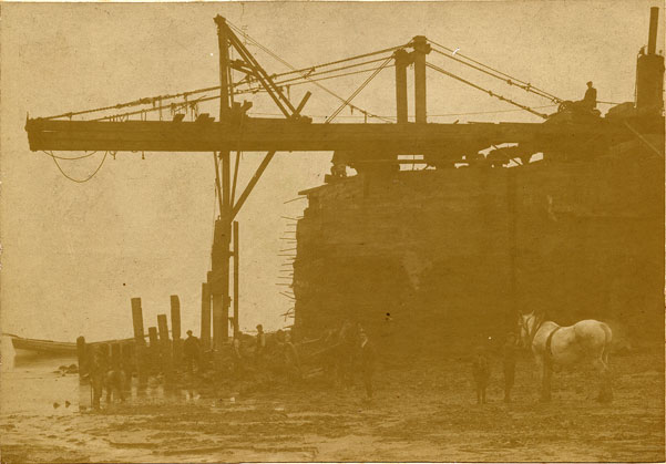
The construction process of the south pier probably followed that of the north for most of its length, when it was built up from a foundation of solid rock. However, the end of the pier extended beyond the surface rock and the last few yards had to be built on piles that were driven down through sand to provide a firm foundation. The scale and ingenuity of the equipment used to drive the piles is evident in a series of photographs from William Robert Archbold's collection.
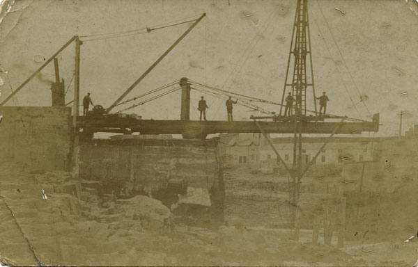
The following image is from a card posted on November 3rd 1909 and carried the message: "This is a photo of the pile driving on the south pier."
The pictures show a heavy set of shear legs on the pier helping to support a large wheeled beam that projects over the solid end of the pier. This carries a pile driving apparatus, apparently powered by a steam driven winch, that hammers in the piles to support and anchor the end of the pier. This being work that could only be undertaken at low tide and in calm weather clearly made the completion of the pier more uncertain than that of the work built on to solid rock. The "Ports & Harbours of Northumberland", by Stafford Linsley gives a detailed and most interesting account of the early days of the harbour. Published in July 2005 (ISBN: 9780752428925) |
 |
Home Programme Membership Archive War Memorials History Walk Miscellanea Links Contact Us
